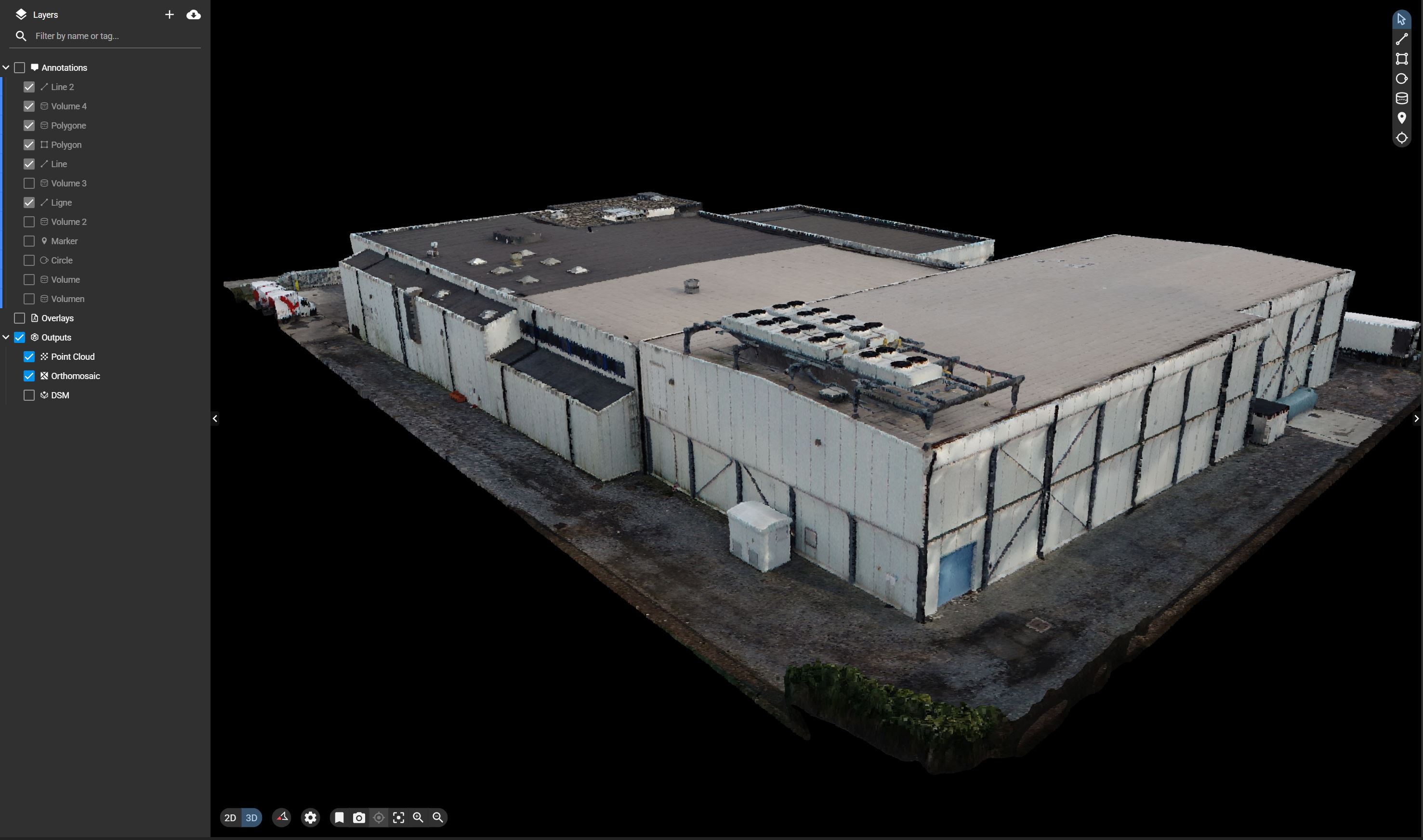
Web Viewer
An online web viewer that allows you to visualize all the data without the need for installed software
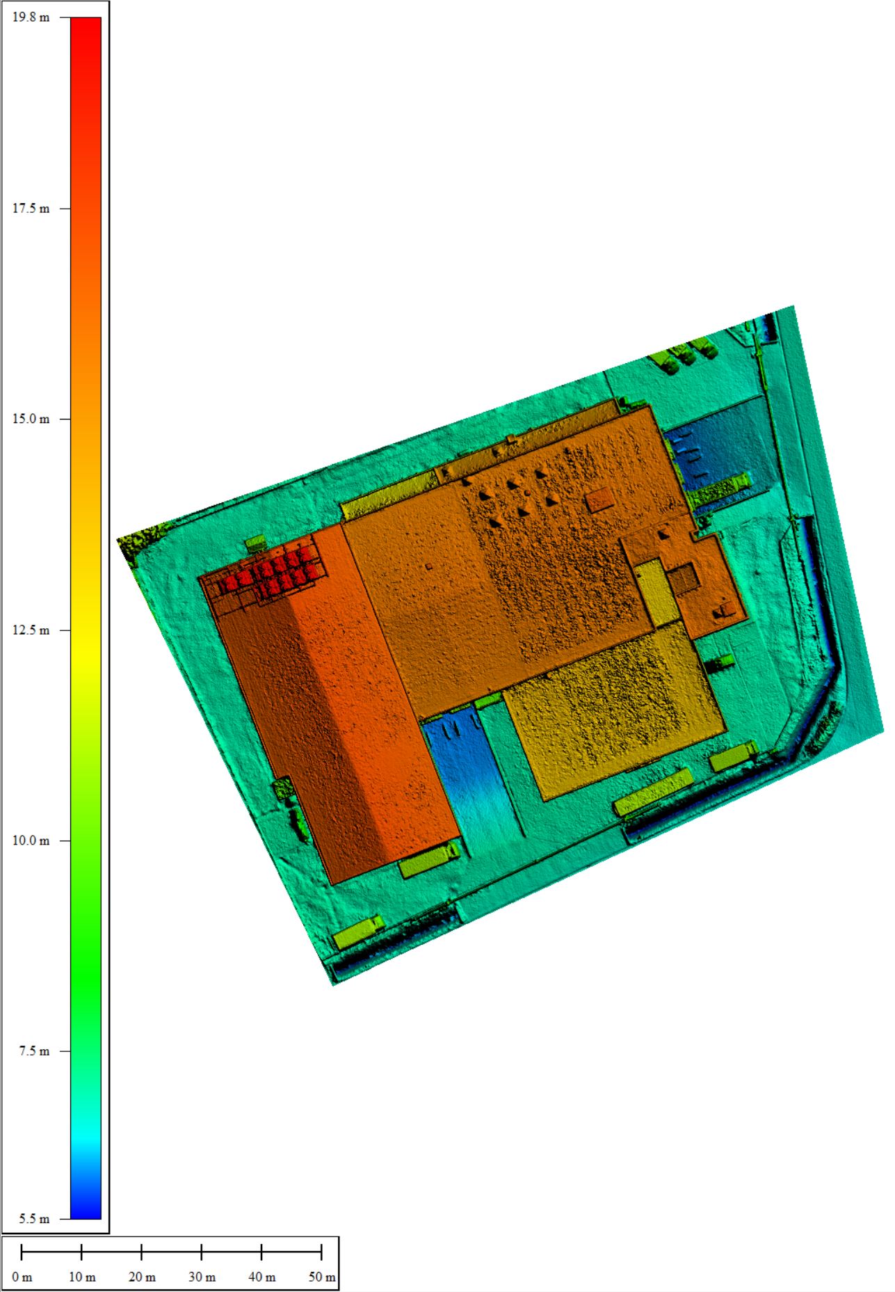
Digital Surface Model - 2.5D
A 2D raster where each point has the coordinates and the height of the as-is situation. Ideal to understand slopes and elevations of a terrain or roof.
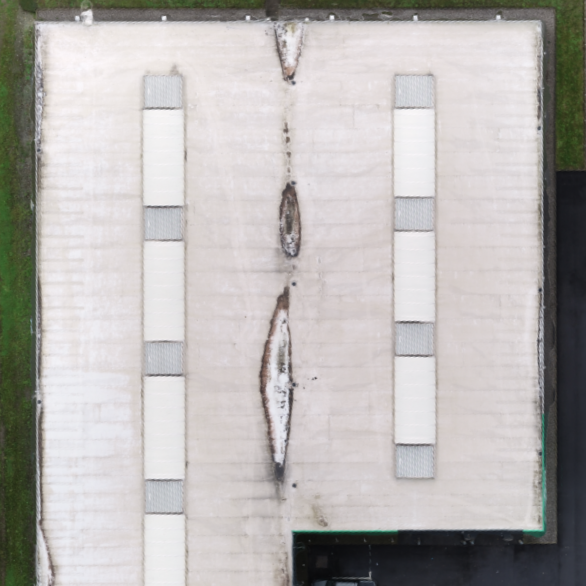
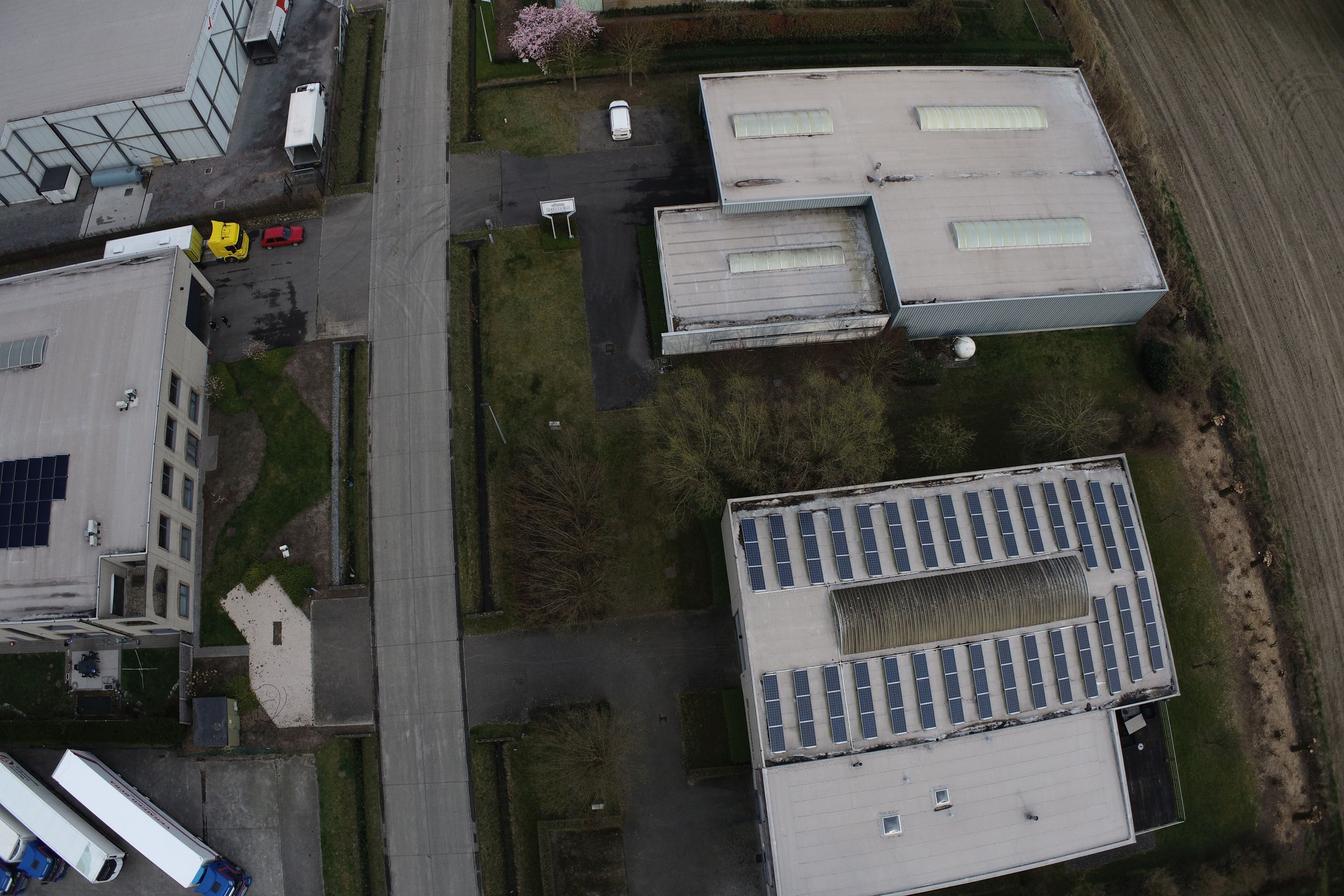
Orthomosaic - 2D
Picture of as-is situation by projecting it to the ground and viewing it from the sky. It is very similar to the satellite viewer of maps, but with a much higher resolution.
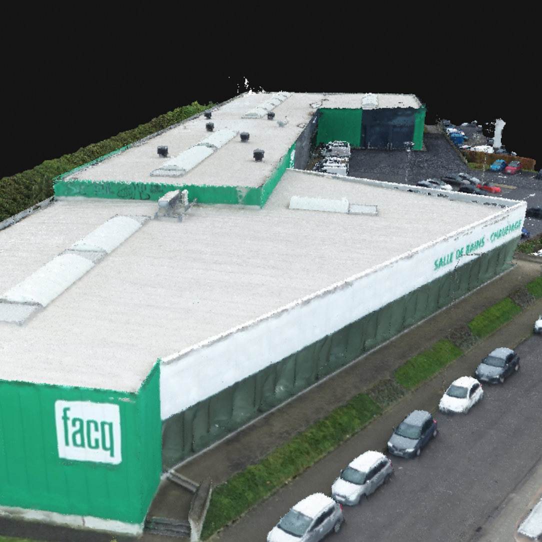
Textured Mesh - 3D
The as-is situation is approximated with a set of triangles. Each triangle has a picture projected on it to represent the object realistically
Unprocessed Pictures
The pictures with embedded coordinates by flying the drone
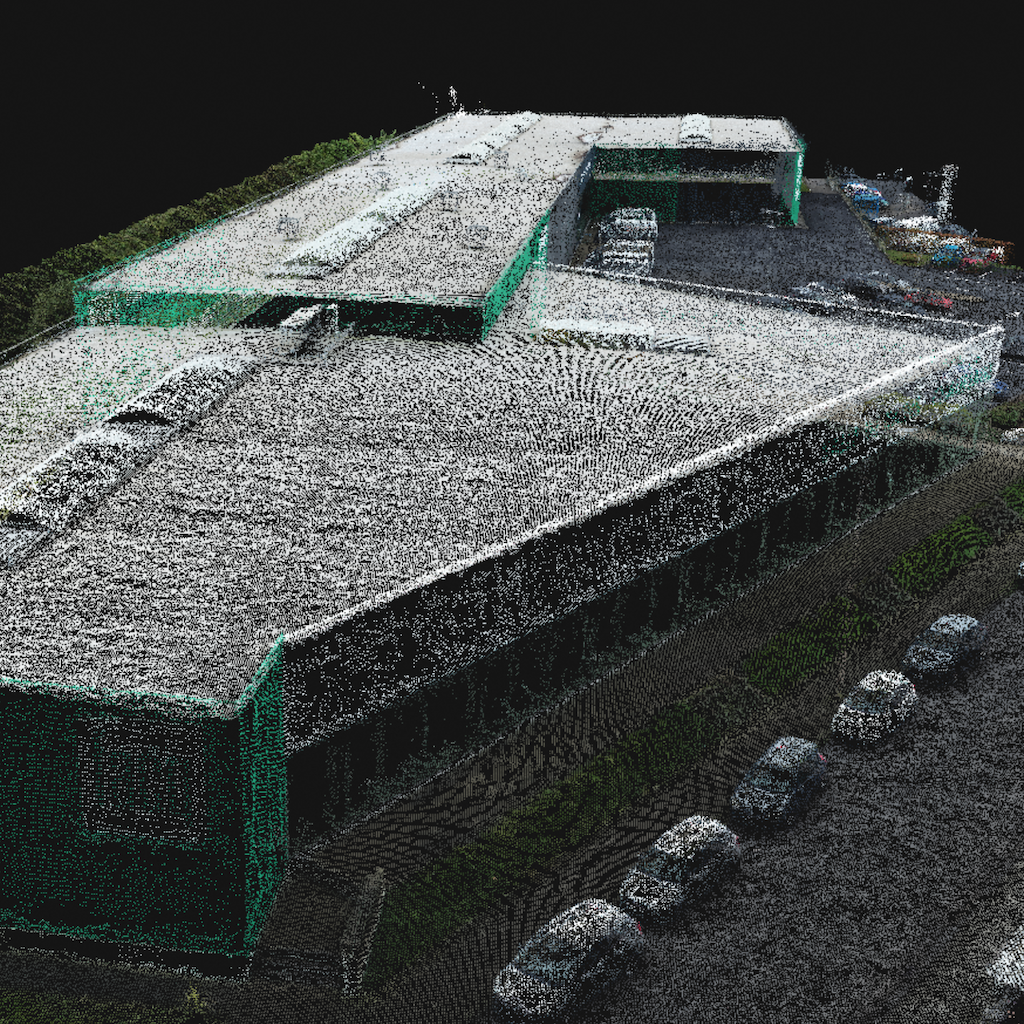
Point Cloud from Photogrammetry - 3D
The as-is situation modeled by a cloud of points, each with the original color and the XYZ coordinates of the object.
Façade and Roof Mapping
Facade inspections need to be performed very often. However, some areas are very difficult or impossible to reach by traditional means. With a drone we can reach anything and everything, and we can provide an image that can be overlaid with a 2D engineering plan.
Process
Instead of building a scaffolding, or having people descend along your facade hanging in a harness, we simply send a drone operator to the location. We then take accurate pictures of the facade in a specifically designed pattern. Our photogrammetric experts then process these pictures. The results of this process are an accurate point cloud and an accurate Orthomosaic.
Deliverables
Based on the point cloud and pictures, our engineers will project your facade onto a 2D plane. The facade is represented in a perfectly accurate scale.
The orthomosaic of the facade allows you to inspect all the details of the facade, and can be used in engineering plans, since all dimensions and scales are accurate up to 1cm. As such any inspection, restoration, or architectural process can be easily performed.